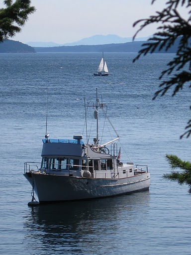
From Sullivan Bay we went to Greenway Sound which was wonderfully
reflected in glassy smooth water. We found where the marina USED to
be. It was a wonderful spot, but too deep to anchor. We took a short
tour and found that the southern section had extensive logging
visible, so we returned to the mouth of the inlet.
A sailboat, whose crew we had met at Sullivan Bay, occupied our
first choice of spots, so we nosed around an islet -- a quite
nerve-wracking experience for me where I was to be on bow watch, and
it was NEEDED -- and anchored in 65-80 feet of water, depending on
the state of the tide. We knew it was a rock bottom because we
could hear the chain rubbing as we shifted. It sounded like rumbles
of distant thunder. We both said we were glad our cabin is in the
rear of the boat where we couldn't hear it as well.
 |
| Not everything we see is beautiful. Everywhere we go there is evidence of logging. This is along Sutlej Channel. Mostly it doesn't bother us, unless it is CLOSE like this is, or a recent clear cut. |
Kingcome Inlet reminded us much of Knight Inlet, though shorter and
narrower. It was a sunny day, and glorious. It got me to thinking --
this was only the third DAY of sunshine in six weeks in the
Broughtons! A day going up Knight Inlet, a day in Booker Lagoon, and
now a day in Kingcome Inlet. We may have had sun breaks, a few hours
of sun here and there, but not days.
Try to imagine the two pictures below as one big panorama. (Google editor won't allow me to align them together...)
This is our entrance to Kingcome Inlet.

In the area where Wakeman Sound branches off from the Inlet, we saw
dolphins in the distance. Then a whole pod were racing across the
inlet, passing right in front of us! It looked like it truly was a
race, as they barreled right up to a rock on shore!
 |
| The race begins |
 |
| The finish line! |
Even though we have discovered how to set the camera to continue shooting as you hold down the shutter button, dolphins move SO quickly that they are very difficult to capture. I told Al as I was shooting that I would have over 200 pictures to go through. But at the end of the day, it was 426. On the first edit, over 200 were deleted.
 |
| Bronson wanted to see what all the commotion was! |
 |
| Just above Wakeman Sound, this mountain has TWO very interesting features. |
 |
| A lacy, humpy waterfall |
 |
| And very little water, but a big SWOOP at the end would make quite the waterslide! |
 |
| Charles Creek. The jetty in ruins once served a cannery, perhaps around 100 years ago... |
 |
| The end seems SO close, but it is still 6 miles away! |
Around the corner to the left, we are looking for a 'modern pictograph'.
 |
| This is NOT what we had in mind! |
To be honest, when I first saw a picture in a guide book, I was all ready to not like it. It just didn't seem to 'fit', in my mind, of something to put on a natural feature. BUT, now that I've seen it 'in real life', I love it! It measures 26 feet x 38 feet, but everything here is SO big, that this is almost dwarfed.
 |
| My picture looks nearly identical to the one published in Waggoners. |
 |
| Turned around and heading back, we see 'the pokey mountain' in the distance. It appears he is playing Joe the Volcano. |
As we returned down the inlet to Belleisle Sound, the dolphins were
ready for more interactive play! They followed us for quite a
stretch, playing in our wake, swimming alongside, and diving
under the bow. Magical!
 |
| WOW! Right along side! |
We liked our anchorage so well, we stayed two nights!
 |
| Port side, looking north. |
 |
| Across the bow, looking east. |
 |
| A Belleisle sunset! |


No comments:
Post a Comment
Note: Only a member of this blog may post a comment.